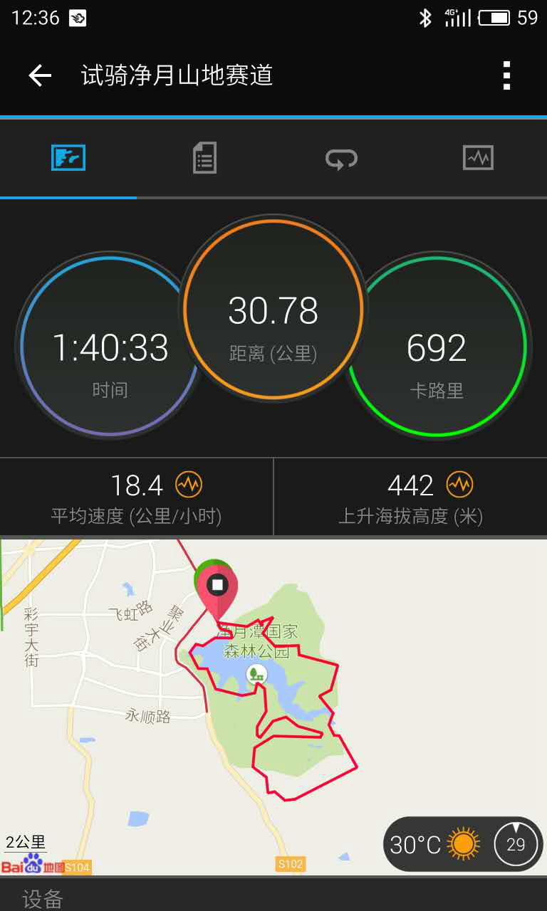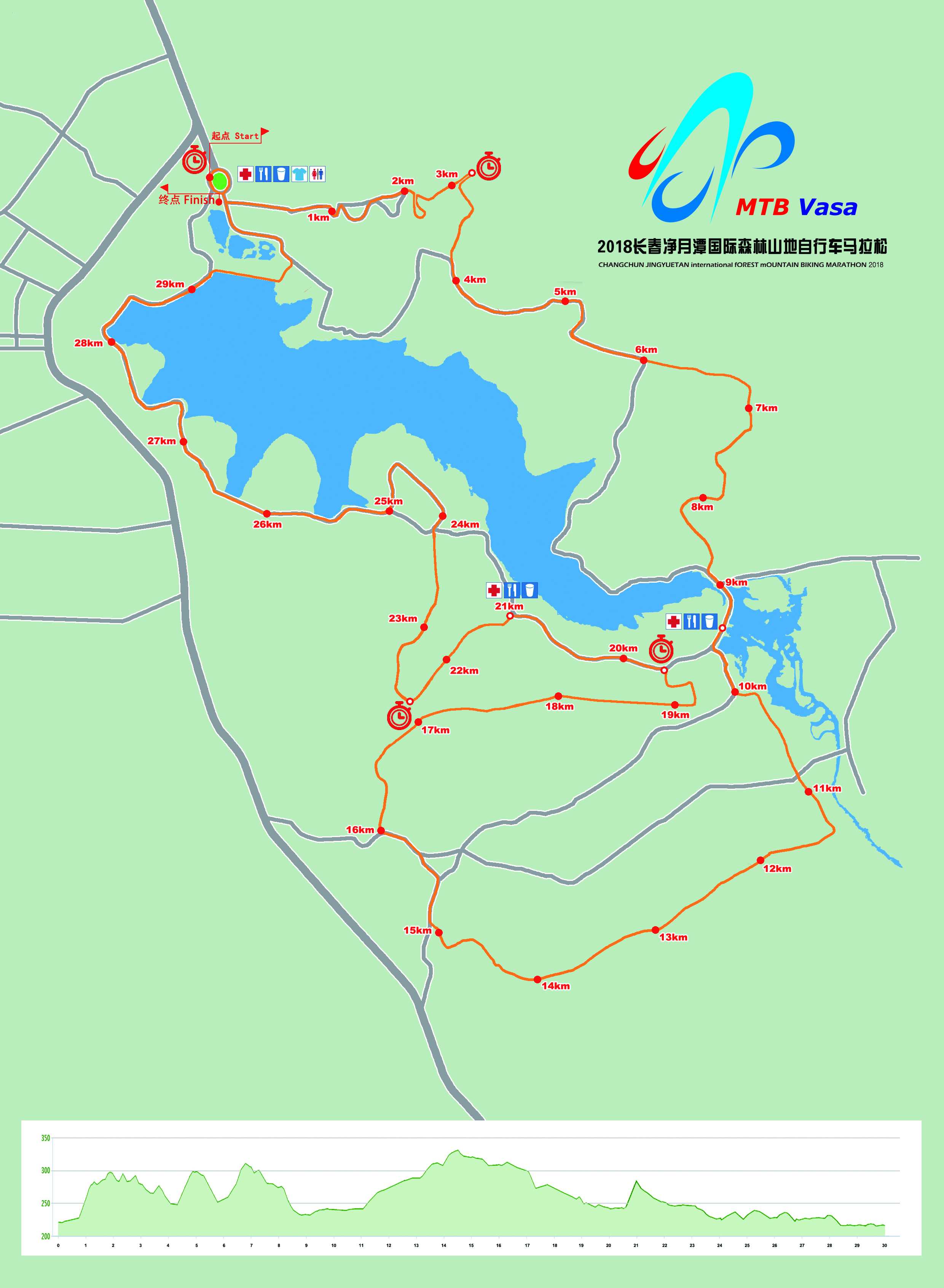
Location: Changchun Jingyuetan Forest Park (AAAAA level)
Track: Total length is 30km, means participants in 60km race need to ride two loops. The track involves mountain slopes and forest sand ways. Ascending in one lap (30 km) is 460m and max slope is 23 degrees.
Start – 5km
Spot: roller skating field, pine ridge
The 1st km is flat, then 2-3km is a little hard, with a continuous uphill slope along paved road (max is 14 degrees,100m climb). The 1st checkpoint is here. The followed 1km is downhill, road and mountain mixed. Then the track goes around the lake, up and down.
5km – 10km
Spot: deer park, Dongjiatun east mount
Road around the lake is going another 2km, 50m variety of altitude, max slope is 10 degrees. Then it converts to 2km forest trail downhill. The 5th km returns to the lake, more flat. Therell be the first drinking station at the stream bridge.
10km – 15km
Spot: southeast 2nd ring road
Most time youll ride in the forest, and climb about 100m. As the track is covered by grass, please pay attention to muddy puddles.
15km – 20km
Spot: forest fire exits
Off-road downhill, about 80m. A checkpoint at 19.5km.
20km – 25km
Spot: vasa museum, skiing 5th lane, vasa bridge
The 1st km is flat road around lake, then comes the steepest slope along the skiing 5th lane, which is grassland, 23-degree-slope and 75m altitude rising. This slope is 1.3km long. After conquering it, enjoy the 1.7km downhill in forest. The 2nd drinking station is set at vasa museum in 21km and the 3rd checkpoint at 22.5km.
25km – 30km
Spot: bathing beach, dam, lotuses and willows
Last 5km goes along the road around lake, generally flat. Sprint out to the finish!
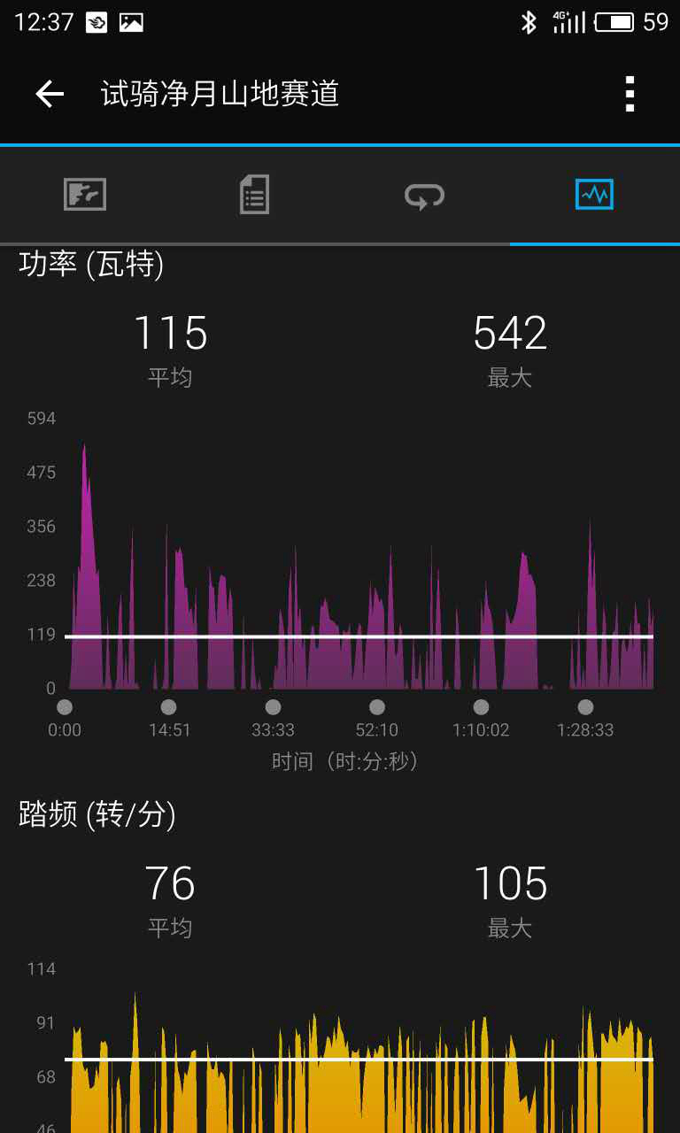
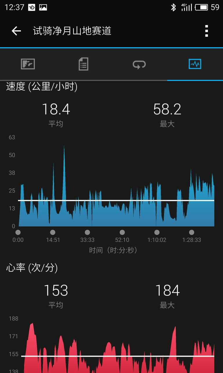
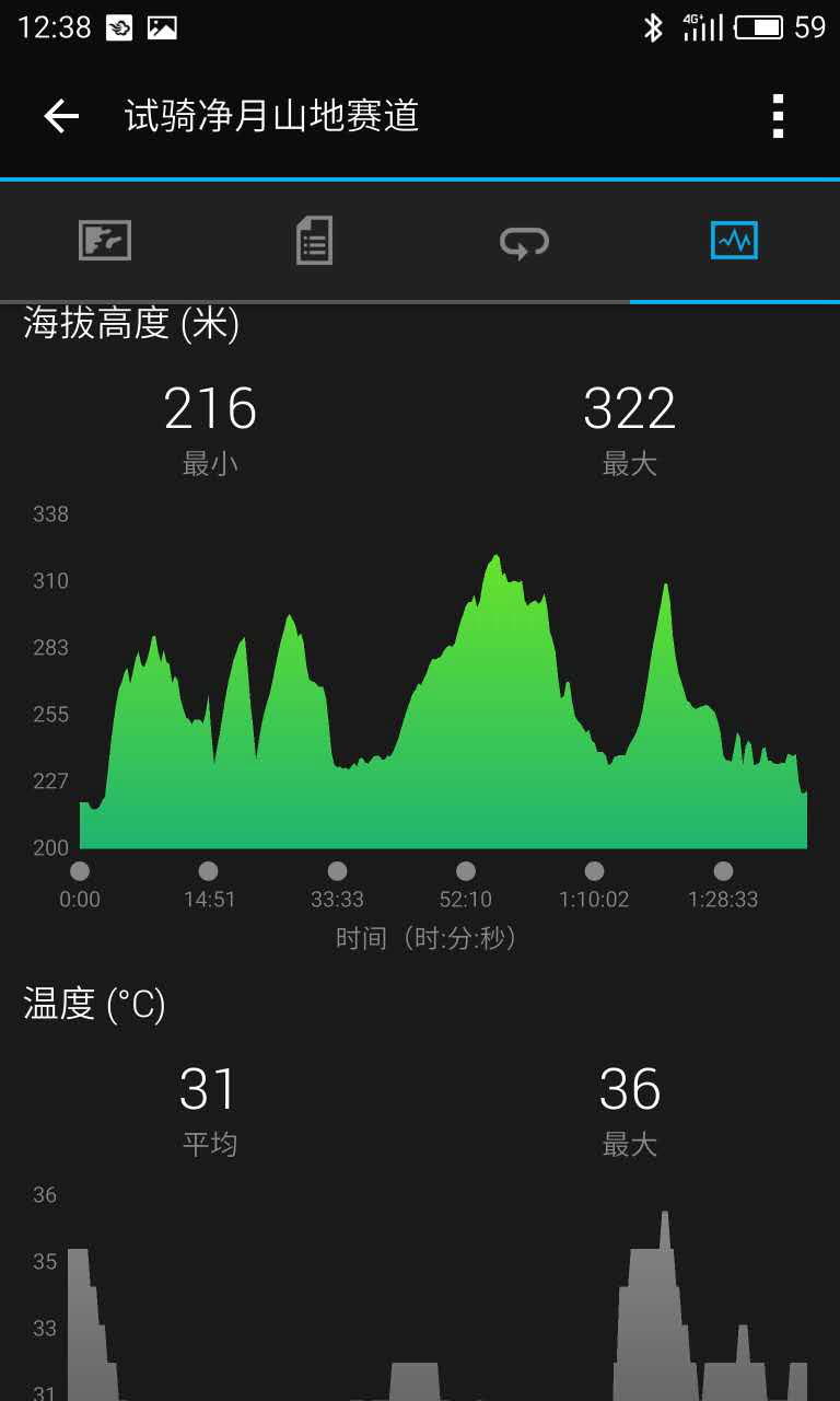
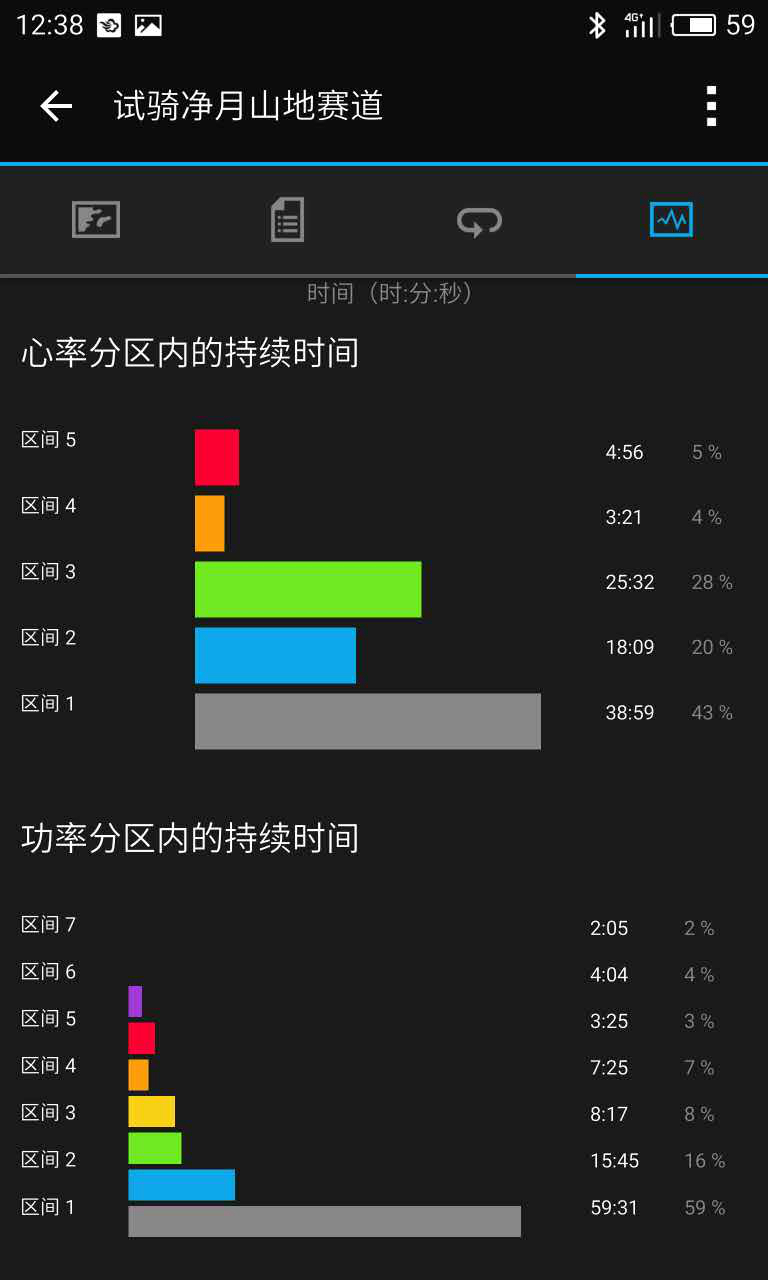
Finally, here are the 30km test-ride data by our ftp240w 80kg staff.